
If you missed the climate strike, good for you. Liars organizing under-age green-shirt socialists should not be positive news. But that’s how the media and left spin it. But that’s not to say there’s no good news. Catastrophic Sea Level Rise is still a fraud and here’s more proof.
Related: Read This and You’ll Know More About “Sea Level” than 99% of Climate Cult Alarmists.
Extensive detailed imagery from 1943 was obtained by the US prior to the military assault on what is now Kiribati. If you want the history and background, look here. We’re more interested in the results, not why we have this data.
The Tarawa Atoll, like the Maldives, should not exist. It long ago should have been swallowed by the rising seas. The climate refugees long settled in other lands.
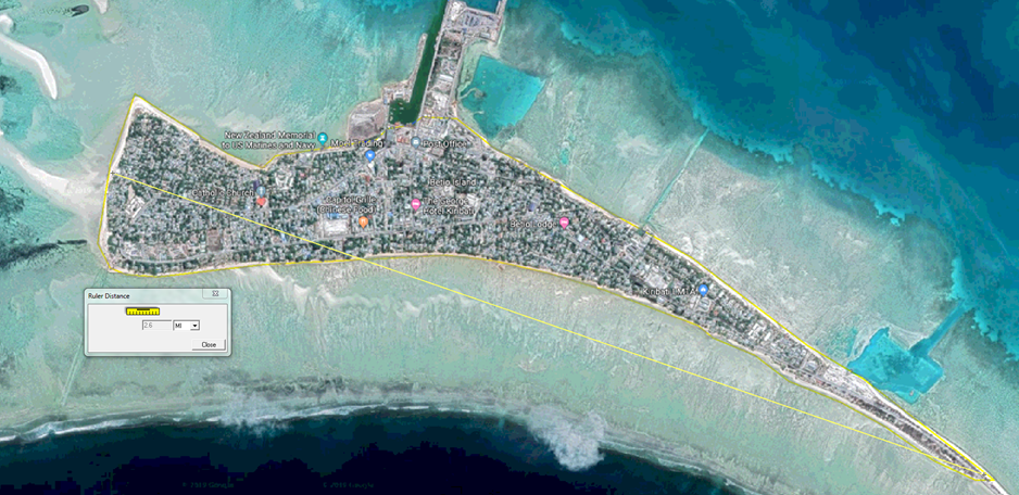
In 1943 Betio, part of the Tarawa Atoll (Kiribati),
“was less than three miles long, no broader than 800 yards at its widest point and contained no natural elevation higher than 10 feet above sea level. “Every place on the island can be covered by direct rifle and machine-gun fire.” observed Edson.”
Every inch of the island was surveyed, detailed, and documented.
David Middleton went to work on the data from then and now and came to a (not so surprising) conclusion.
After 76 years of Anthropogenic influence, Barito, while the sea has risen a few millimeters the island is longer and has more area than it had in 1943.
The same folks who say these Islands should be gone promise us that in a few decades the same thing will happen to our coastlines. For New Hampshire, they say we need to spend 1.3 Billion to build (get this) a wall to hold back the sea. As if that’s how they’d spend it.
| WUWT