
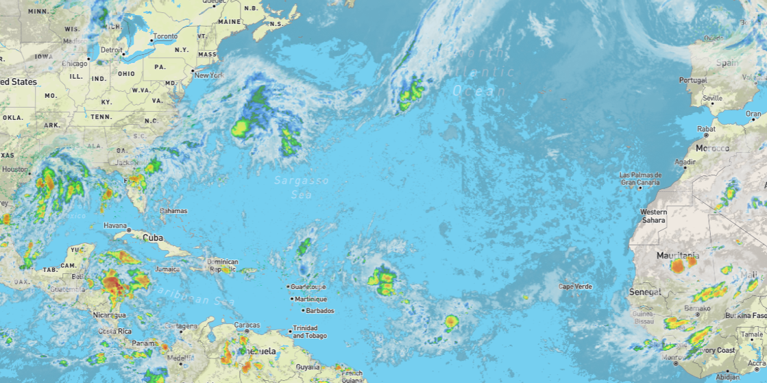
With only five days until the cyclone season peak (9/10/24), the climate kids are all a flutter. NOAA is simultaneously tracking five disturbances across the Atlantic basin that could develop into cyclones. How likely is that? Not very. Not yet.

I modified the latest NOAA map with their percentage chance for each disturbance.
At this point, I think they’d be happy if they just started spinning wildly so they could name a few. Sure, a few Category 6 hurricanes would be the bee’s knees (for the Cult), but they really aren’t necessary. The lack of them is (as predicted more than once by many) proof that you have broken the climate. That’s right. Their inability to predict the weather is your fault, and the fact that the super warm water in the Atlantic isn’t puking hurricanes faster than a drunken frat boy is proof.
It’s broken. No one can explain it. And that is because they have satellite records going back a few decades (and anecdotal ones covering a few centuries) on a planet that we’ve been reminded is several billion years old.
Reality says, yes, we should have a lot of hurricanes, but as I reported earlier this year, we’ve seen science that suggests an answer to the problem. You don’t get more landfall hurricanes when the average temps are higher becasue the planet has no reason to move that energy around.
Another important factor in hurricane frequency is the difference in temps between the equator and the poles. The greater the disparity, warmer oceans, and colder ice caps, the more likely we are to have more, stronger hurricanes. That’s according to professor and climatologist David Legates, who also explained why we will see fewer landfills when the world is generally warmer
The research repeatedly confirms that colder centuries will have more hurricanes and landfalls. Global Warming, doesn’t do what they say. Big surprise. But let’s not be surprised if we get at least one or two named storms out of this and a few dozen more disturbances. Tis’ the season. It just doesn’t have anything to do with the Climate Cult’s money laundering scam.
Update
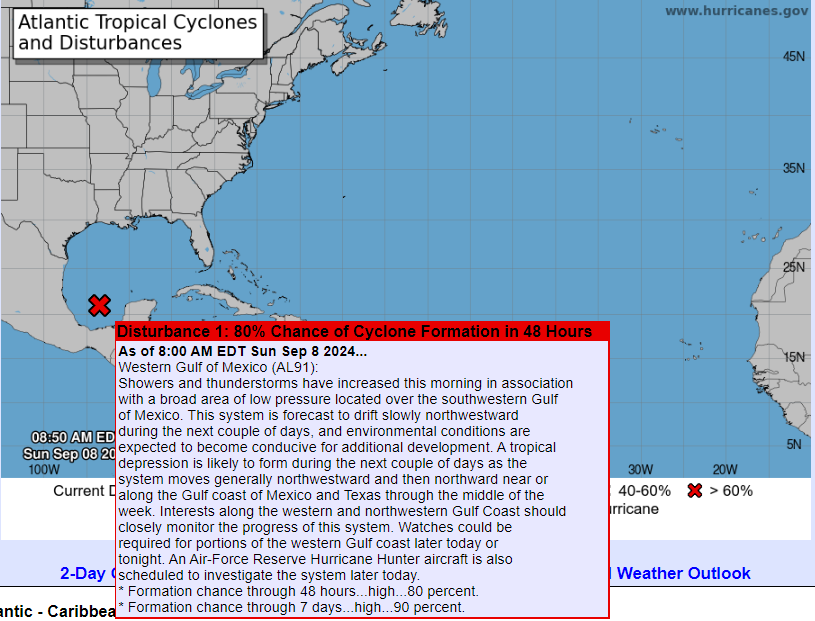
Within 24 hours, the Basin went from five disturbances to three. As of this morning, Sat the 7th, there is only one, but it has been elevated to a 40% chance of becoming a cyclone. It is already over land (Yucatan Peninsula), and NOAA might be grasping (desperate?). Weather Underground doesn’t show the same storm with cyclone potential, but it could move north across the Gulf of Mexico, which Berly did, making landfall in the US as a Cat 1.
The picture, however, is that we are not seeing the scary season predicted, and since the expert models didn’t see it and can’t explain it, it must be magic or the gods; sorry – I meant to say global warming.
Update 2
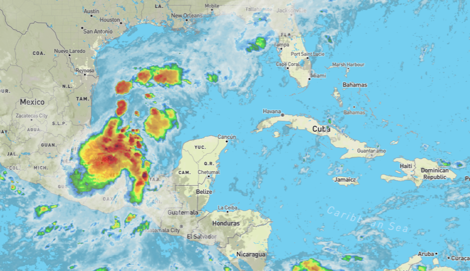
That disturbance over the Yucatan has moved into the gulf with a high probability of becoming a cyclone in the next 24-48 hours.
And here is a radar/satellite view—it looks nasty, and it isn’t even a cyclone yet. The Gulf Coast will have to prepare for a likely hurricane landfall in the next few days.
Update 3 – Hello Francine
INvest 91L has officially achieved cyclone status and is estimated to achieve Cat 2 before slamming into the coast of Louisiana in two days, losing strength as it wades up into the midwest.
