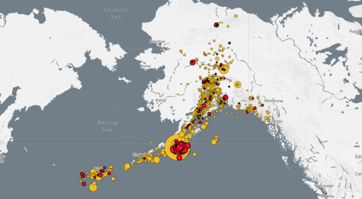
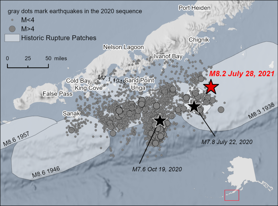
“At 10:15pm Alaska time on July 28, a magnitude 8.2 earthquake struck offshore of the Alaska Peninsula, the largest U.S. earthquake in 50 years. The Chignik Earthquake depth was approximately 28.5 miles, an intermediate-depth earthquake.”
Related:
For the uninitiated (that includes me) The University of Alaska Fairbanks, which tracks this stuff, has recorded 25,510 earthquakes in Alaska, in 2021.
The Wednesday night quake was the largest (in 50 years) in the US but because of its remote location did little or no damage. That’s good news.
More Geeky Earthquake stuff.
The Chignik Earthquake occurred relatively close (about 45 miles) to the location of the M7.6 Simeonof Island Earthquake that ruptured July 21, 2020. The Chignik Earthquake seems to be related to the earlier earthquake; both occurred along the interface between the subducting Pacific and overriding North America plates, although the Chignik Earthquake was the deeper of the two. The Alaska Peninsula is a seismically active region where thousands of earthquakes occur each year. The largest earthquakes are located along the interface, which is called the Aleutian megathrust. The M8.2 event ruptured this interface in the region between the Shumagin Islands to southwest and Kodiak Island to northeast. Previously, the 1938 M8.3 earthquake ruptured this section of the interface.
Alaska Public Media has a more in-depth interview here if you want to geek out some more.
In contrast, NH has “felt” 7 earthquakes in the past year 365 days. The last was on March 19th, 2021, at York Beach, 2.4 magnitudes. The biggest in recent memory, was 2012, 4.0. YOU can see the damage pictured below. We rebuilt and moved on.


