
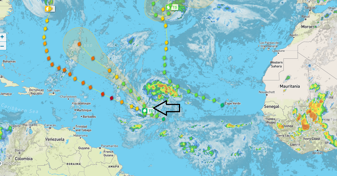
September is living up to its reputation as the peak month for Hurricanes. Storms are pouring off the west coast of Africa in rapid succession, Lee being the latest Hurricane, followed by TD 15, which is projected to be CAT3 when it reaches the Sargasso Sea in a few days.
Here is Tropical Depression 15, isolated from the radar map above. It currently has sustained winds of 35 mph, according to NOAA.
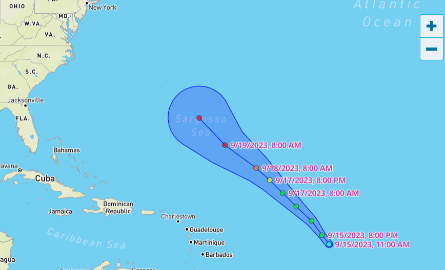
The track looks similar to Lee but a bit further out. Lee ran straight toward Georgia, then the dogleg right, and drifted east. Maine might have avoided the heavy rain if it had more time to sail further east.
This tropical depression (15) is pointed right at Washington DC, which, if I recall the commenters from a previous Hurricane Lee post, is where some readers thought the storm needed to land. I’m sure a few of them are saying, “Stay on target,” but what are the odds it does what Lee did with a slightly more north and easterly swing? Good to excellent. Between when I started this post and this morning, the projection did that exact thing.
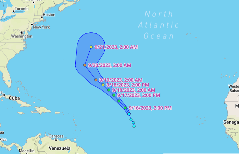
There’s not much chance of it getting anywhere near us, but to NOAA’s credit, this year’s forecast will be much closer than the 2022 projections, which were just lousy. But how close will it have to wait until November?
Until then, it’s very active, and we’ll try to keep track of these things as they pile up in the Northern Atlantic and hope most of them are like Margot, who is still twirling about the middle of the ocean as a Tropical storm.